Stand Mapping
This webpage documents an open-source data science and software engineering effort to produce new tools that segment and label forest conditions using computer vision approaches that can be applied with a variety of imagery and other data sources.
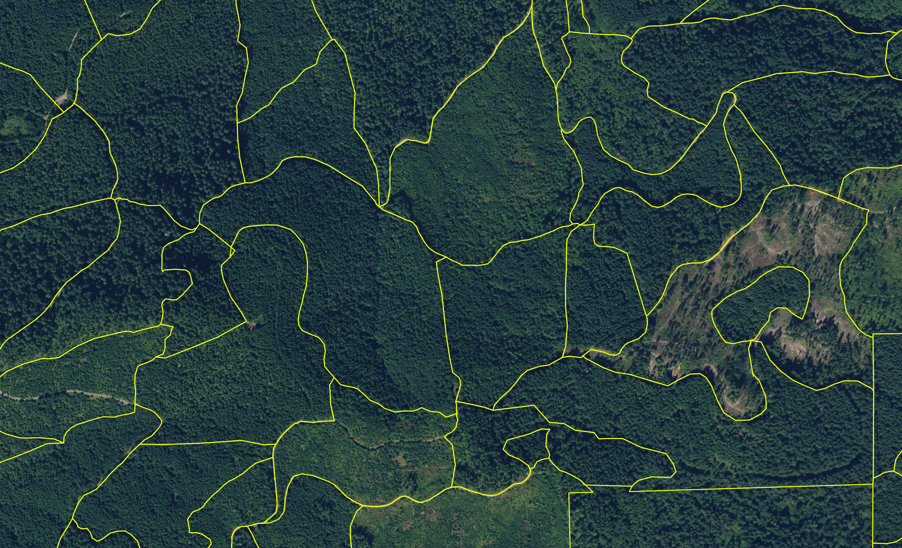
Since widespread adoption of Geographic Information Systems, forest stands are typically hand-delineated by foresters using high-resolution aerial imagery with supporting geospatial layers including property boundaries, roads, hydrographic features, and topography.
Motivation
This software is being developed as part of a broader project with the goal of increasing landowner engagement and adoption of stewardship and conservation activities in forests across Oregon and Washington. Most pathways to adopting new practices involve assessing current and historical forest conditions and preparing plans to implement and follow-up on new activities. This typically involves mapping and characterizing forest stands and gathering publicly-available information in the forms of maps and tables. This work and information can be costly, time-consuming, or difficult to access, limiting the adoption of new stewardship practices by landowners who might otherwise be inclined to do so. We are investigating whether and how a web-based forest mapping and planning toolkit could reduce these barriers.
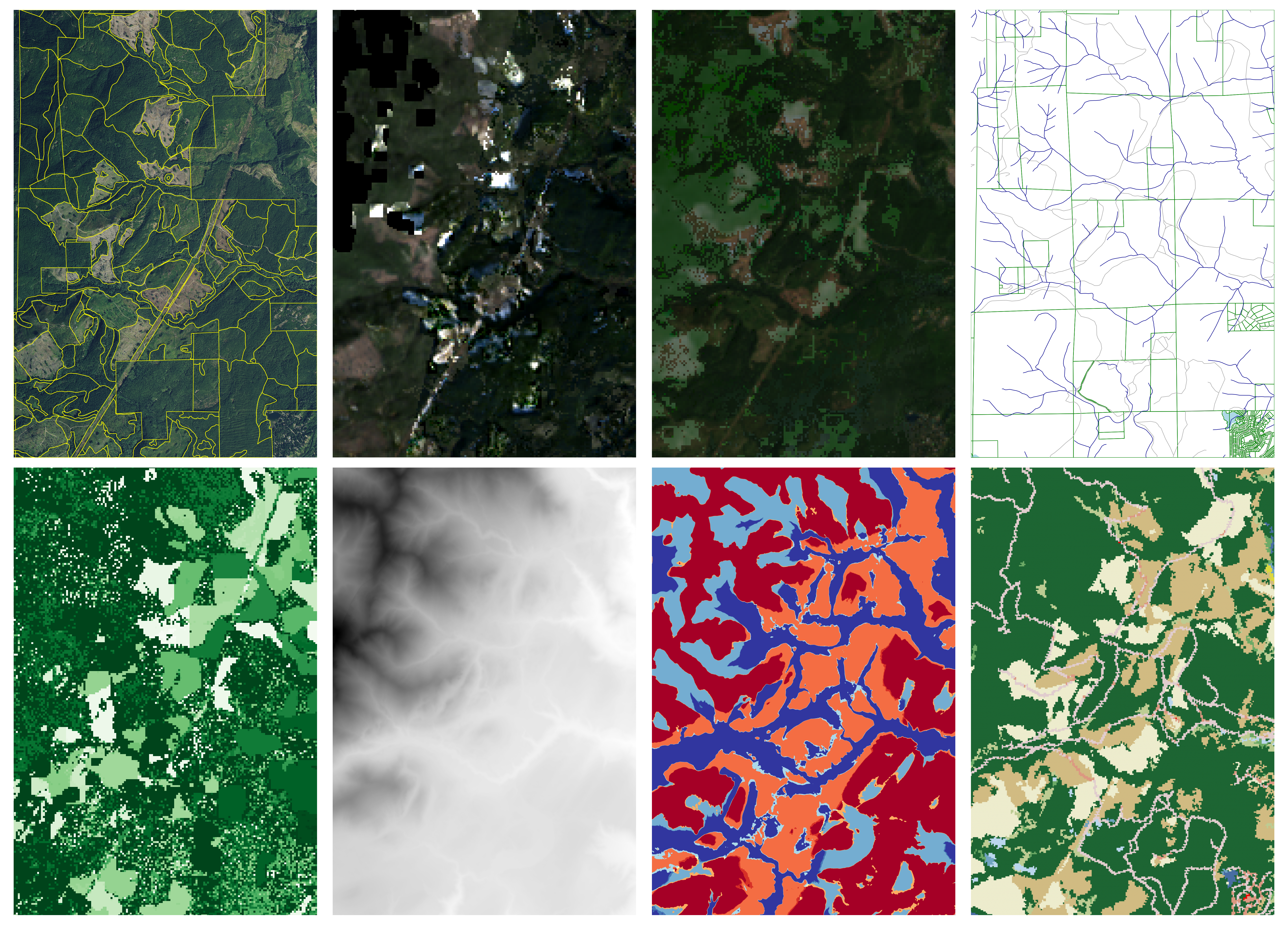
We are utilizing a stack of data layers to help train new algorithms to delineate land cover “instances” such as forest stands. Our models are based entirely upon free and publicly-available datasets including high-resolution aerial imagery, leaf-on and leaf-off satellite imagery, roads, hydrologic features, parcel boundaries, disturbance history, and terrain and land cover datasets.